





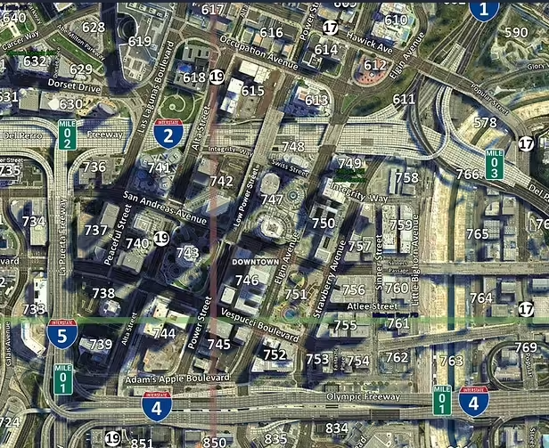
This satellite postal map is Oulsen’s work. The original repository is Oulsen/oulsen_satmap and was archived in November 2025. It remains a source reference, but its archived status does not promise ongoing support or compatibility updates.
Oulsen’s original map repository
Install the resource, not the repository wrapper
The actual map resource is the oulsen_satmap folder. Place that folder in your resources directory and add ensure oulsen_satmap to server.cfg. Back up any existing minimap replacement first; multiple resources streaming the same map textures can conflict.
Keep the image and postal data together
The repository includes oulsen_satmap_postals.json for use with a separate nearest-postal script. The map itself does not provide that script. Configure the postal resource with the matching data, then compare displayed codes against locations on the map and test any waypoint command it supplies.
The repository also supplies grid and nogrid variants. Work on a copy when changing textures and preserve the selected variant’s file names and format. Test the pause map, minimap zoom and several locations across the city and county. A visible map does not establish that another script’s postal coordinates match it.
Source reviewed on 10 September 2026. The creator’s historical first-person account belongs to Oulsen; RPCrate provides this installation and verification guide.